Since we moved to Colorado, I had this goal to one day hike one of the state's numerous fourteeners. Jess and I go hiking often around here, but we'd never attempted one of these. The closest one to us is Mount Bierstadt which is considered one of the easiest fourteeners to climb. From the Denver metro area, it only takes about an hour and a half to drive there. Due to that, this is probably the most visited fourteener in the state.
So that's what we set out to climb a few weekends ago. We planned be at the trailhead by 5am to make sure we got one of those coveted parking spots as we didn't want to hike any longer than we needed to. The trail starts near Guanella Pass at almost 11,700 ft (3,566 m) and climbs about 2,700 ft (820 m) to the summit at 14,065 ft (4,287 m). According to AllTrails, the out-and-back length of this trail is 7.2 mi (11.6 km) and should take around 3-5 hours to complete.
We knew that it would take us longer than average for a hike like this, probably closer to 6-7 hours. So we planned to start around 5am and be back down by noon-ish and get lunch afterward. With this being the biggest hike either of us had ever attempted, we weren't sure if we would make it to the summit. I gave us about a 50/50 chance of making it up there.
Coincidentally, I had just bought the new Apple Watch Ultra 2 a couple of days before we went on this hike, so this was the perfect testing ground for it. I also had just recently learned of this beautifully-designed indie app called Landscape that was made specifically for a hike like this. So I was looking forward to trying it out.
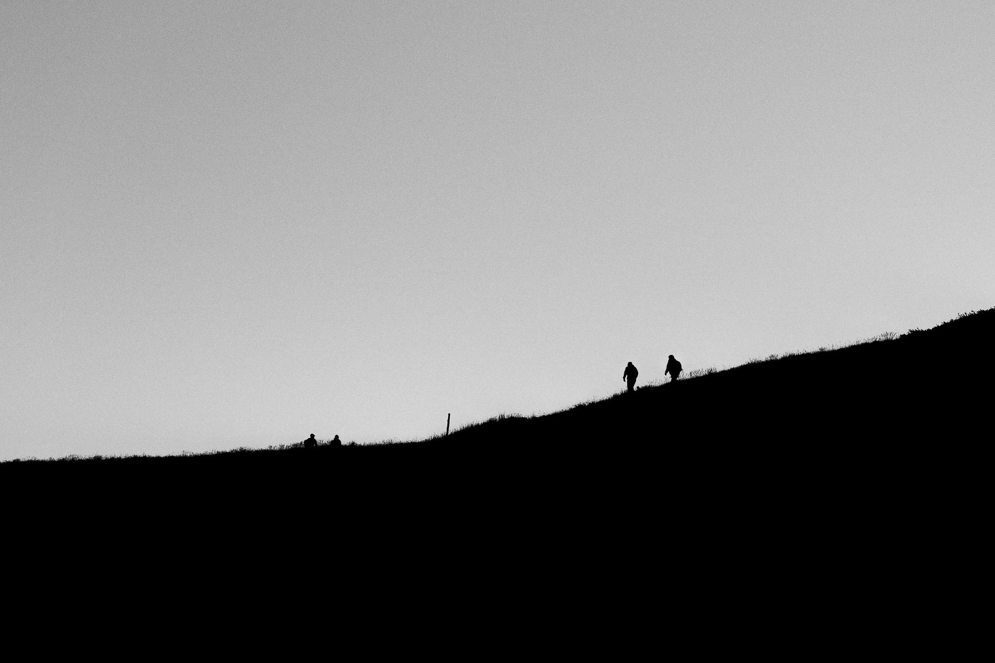
The temperature was right around freezing when we got there and we came prepared with plenty of warm layers and headlamps. Including food and water plus the camera gear, my pack probably weighed close to 15lbs. The parking lot was already filling up but we got a spot. From there we could barely see a faint silhouette of the imposing mountain with a field of stars in the backdrop. I thought it looked quite intimidating. A scattered trail of flashlights from people who started even earlier than us could be seen snaking up the mountain.
We hit the trail at 5:30am and the first mile or so was pleasant as it was mostly flat, and even downhill a bit. The second mile was when the switchbacks began and the trail started to climb with tall bushes flanking us. It was a gradual incline but we made sure to go slow to not tire ourselves out.
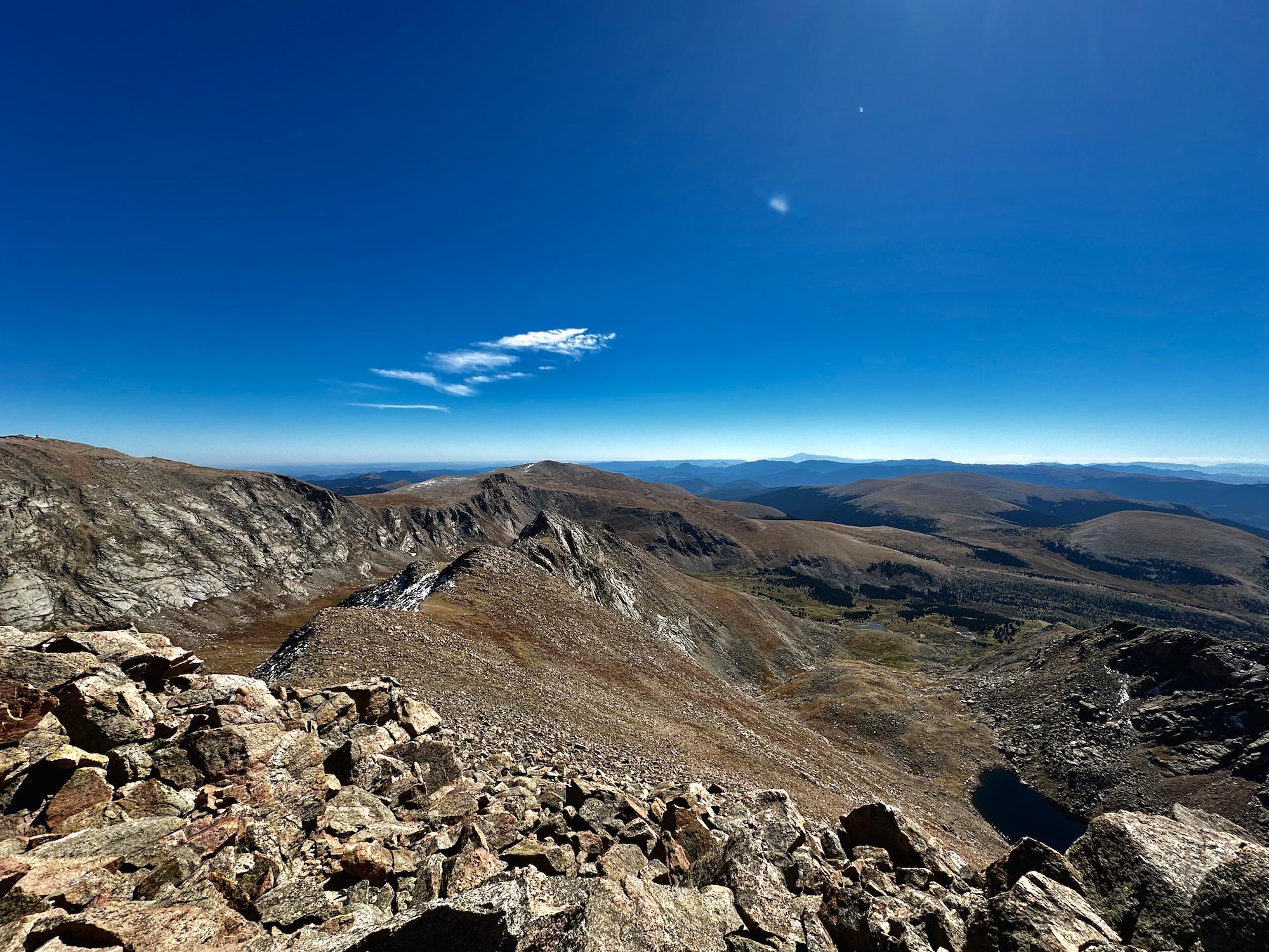
It was an early fall day without a single cloud in the sky. And of course, the sunrise was magnificent.


It's almost 8am and we had been hiking for about two and a half hours. We still had about 1.5 miles and 1,500 feet to go. We were well above the bushes now and the landscape became a lot more rocky with little vegetation. But up in this environment was where we saw some cute wildlife to distract us from the physical exertion.


It's 10:30am, five hours after we set off. We were tantalizingly close, just over 300 feet of elevation to go. The effective oxygen at this altitude is a little above 12%.
As you can see from the photo above, the last bit of this was a scramble up a boulder field. It was a kicker for us but we pushed through. And after nearly seven hours, we finally made it to the summit!
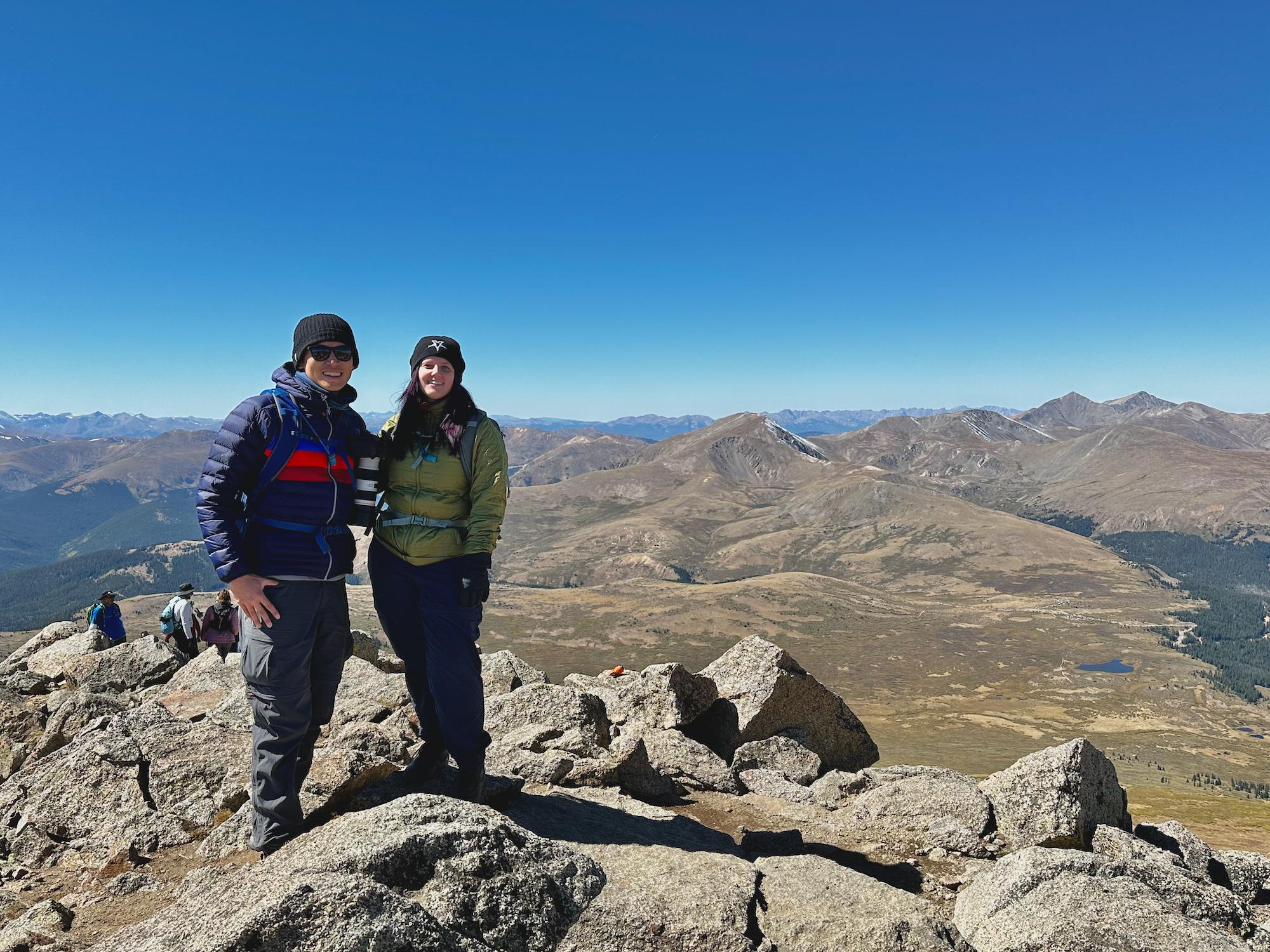
We spent less than an hour at the top. There was a big group up there with us and they were quite loud. Plus it had taken us much longer than planned to get up there, so we knew we had to get going. Looking down to the parking lot and seeing how tiny and far away it looked was incredibly discouraging for me. Getting up there really was only half the battle. I almost wished I had a glider.
But not long after we started climbing down, another distraction came our way.
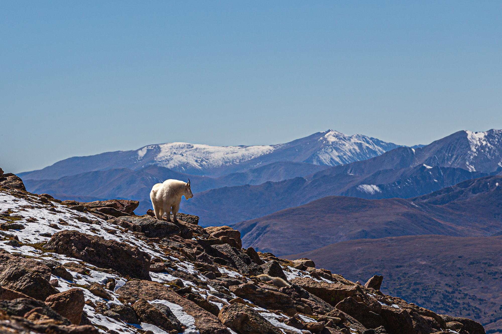
It was more than just a single distraction. We got a herd of them.
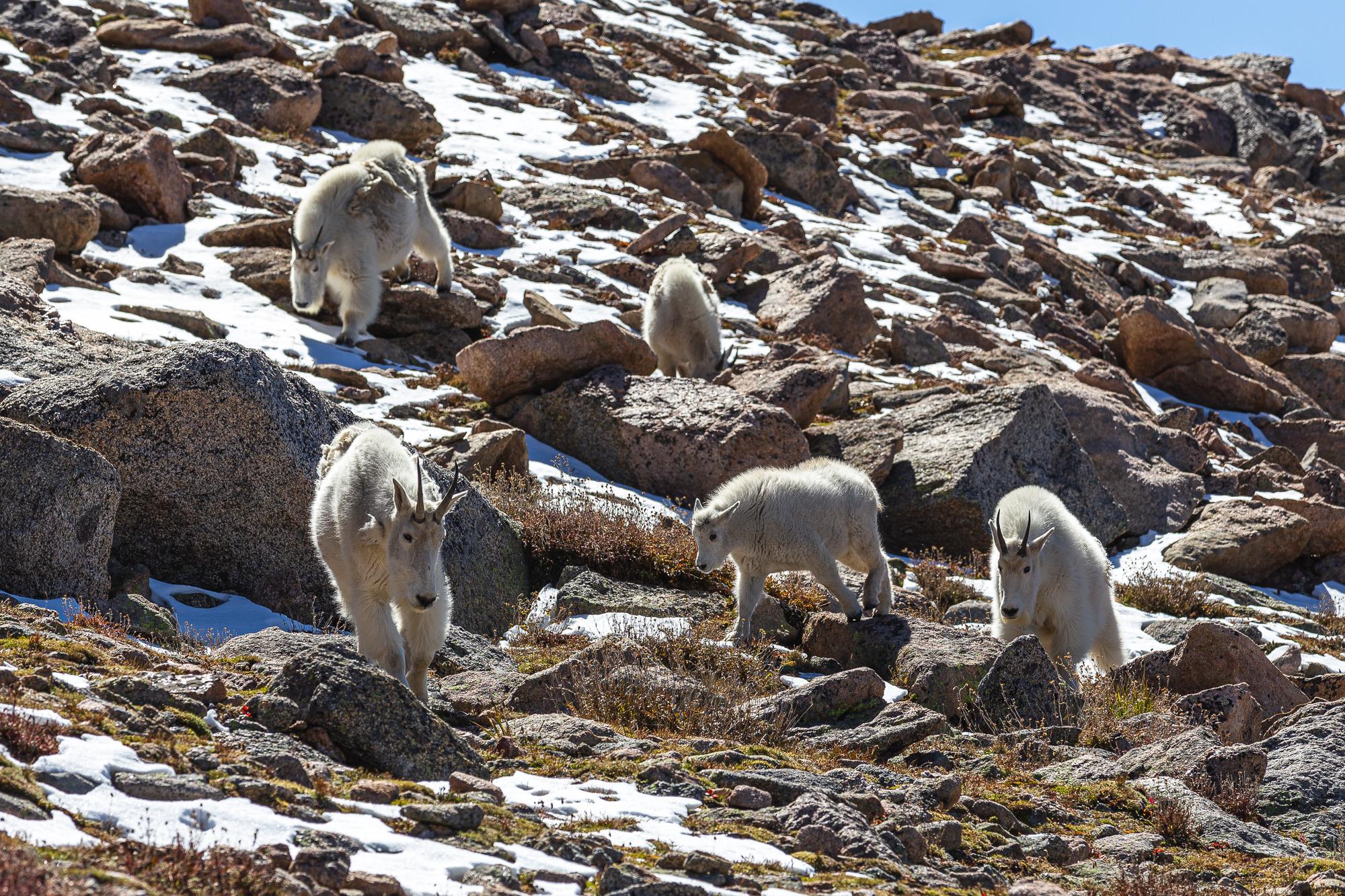
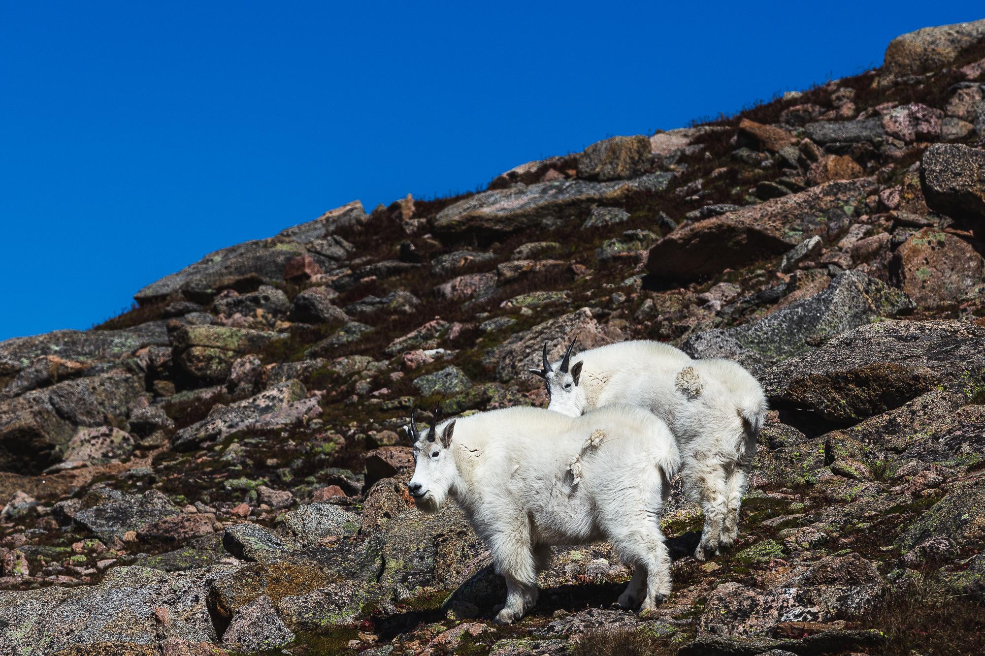
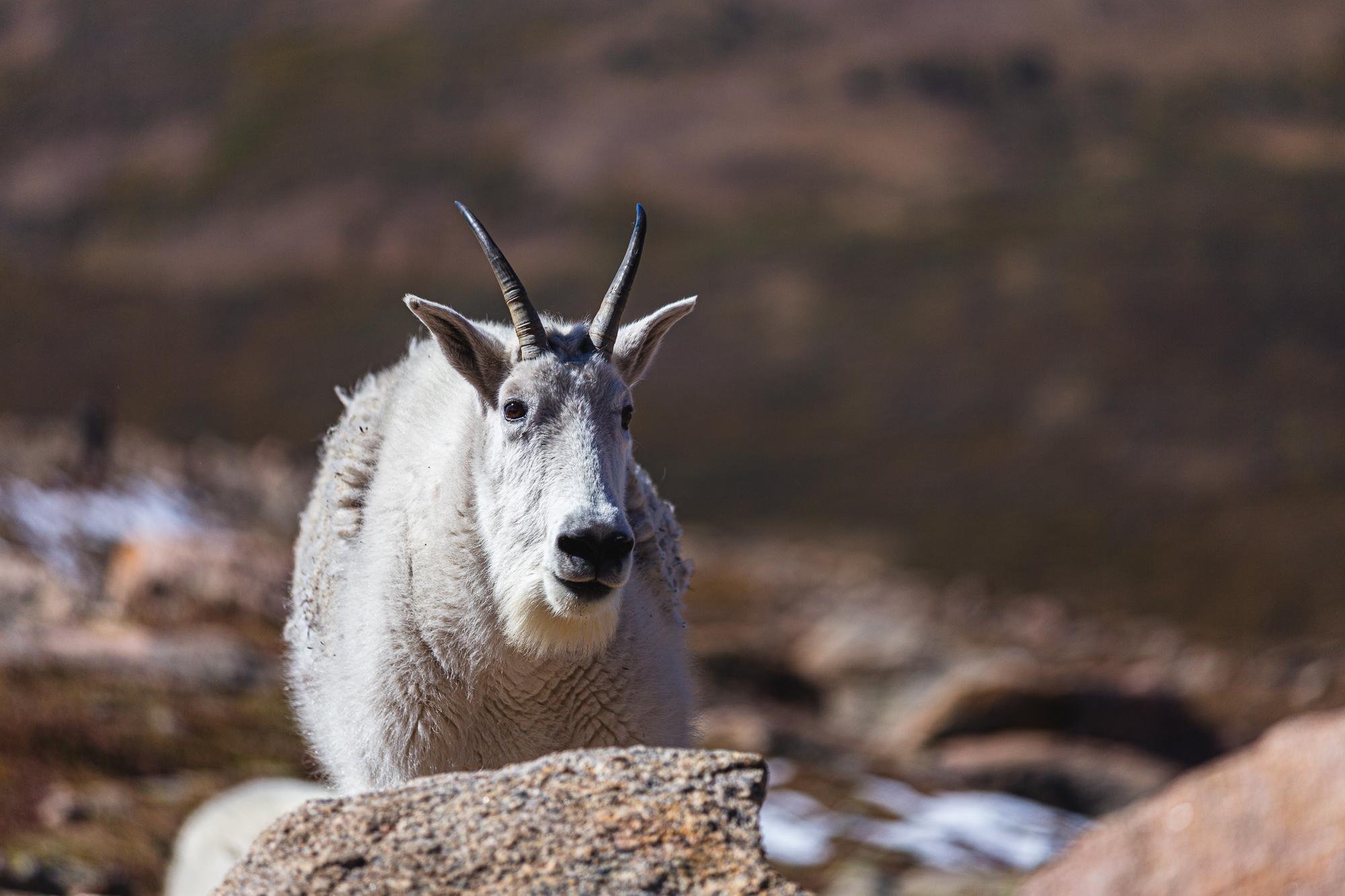
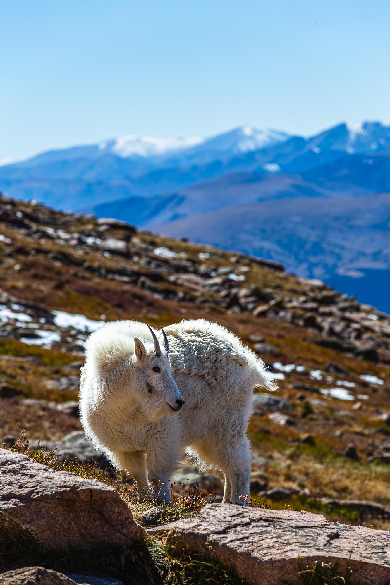
I spent way too long taking way too many photos of these mountain goats. But they made the extra work carrying the heavy camera gear up the mountain all worth it.
The next few hours were not at all enjoyable. It wasn't as physically demanding as going up in terms of cardio effort, but our legs and knees hurt from stepping down on these rocks that seemed to just go on forever. Plus we were hungry as we only packed enough food for breakfast and light lunch.
After what felt like an eternity, we eventually made it to the car at 5:30pm, four and a half hours since we left the summit, and exactly twelve hours since we started. There was almost nobody left on the trail or in the parking lot. Looking back at the peak, I couldn't fathom how we made it up there to begin with. The hike up felt like a distant memory or a fever dream. It didn't feel like it really happened. We were that exhausted. We didn't get back home until 7:30pm, sixteen hours after we left that morning.
As for my new Apple Watch Ultra 2, I ended up draining its battery more than I expected as it had about 10% left when we got back home. It was running both AllTrails and Landscape the entire time and I didn't enable low power mode on it. My old Apple Watch Series 6 would have died not halfway up the mountain. My phone was also running AllTrails all day and it died halfway down the mountain.
In hindsight, what we really should have done was to take note of our pace on the way up, and figured that it was going to take us way too long to complete the hike. That was a rookie mistake that we'll be sure to not make again. We should have turned around when we saw that it's been over two hours and we were barely halfway up. We were lucky we went there in the fall. Had we gone in the middle of the summer, we would surely have been hit by afternoon thunderstorms. And with the lack of any tree cover on this trail, we would have been in trouble. Also, it's always a good idea to pack more high-calorie food and snacks than you think you'll need.
Sitting here now in the comfort of my home, I'm glad that we went on this hike, even though it turned out to be more of an adventure than we were prepared for. I know I'll attempt more of these in the future.